Class 9 Geography
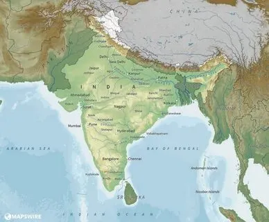
Chapter 1 : India – Size and Location
Lorem Ipsum is simply dummy text of the printing and typesetting industry. Lorem Ipsum has been the industry’s standard dummy text ever since the 1500s, when an unknown printer took a galley of type and scrambled it to make a type specimen book. It has survived not only five centuries, but also the leap into electronic typesetting, remaining essentially unchanged.
Class 9 Geography Chapter 1 : India – Size and Location NCERT PDF
Our Topics Links
Class 9 Geography Chapter 1 : NCERT Question
(Latest CBSE Syllabus)
1. Choose the right answer from the four alternatives given below.
- The Tropic of cancer does not pass through:
- 1 Rajasthan 2 Chhattisgarh
- 3 Odisha 4 Tripura
2 The easternmost longitude of India is
1 n97025’E 2 77025’E
3 6807’E (iv) 4 82032E
3 Uttarakhand, Uttar Pradesh, Bihar, West Bengal and Sikkim have common frontiers with:
1 China 2 Nepal 3 Bhutan 4 Myanmar
4 If you intend to visit Kavarati during your summer vacations which one of the following Union Territories of India you will be going to:
1 Puducherry 2 Andaman and Nicobar
3 Lakshadweep 4 Daman and Diu
5 My friend hails from a country which does not share land boundary with India. Identify the country.
1 Bhutan 2 Bangladesh
3 Tajikistan 4 Nepal
Answer the following questions briefly.
Lorem ipsum dolor sit amet, consectetur adipiscing elit. Ut elit tellus, luctus nec ullamcorper mattis, pulvinar dapibus leo.
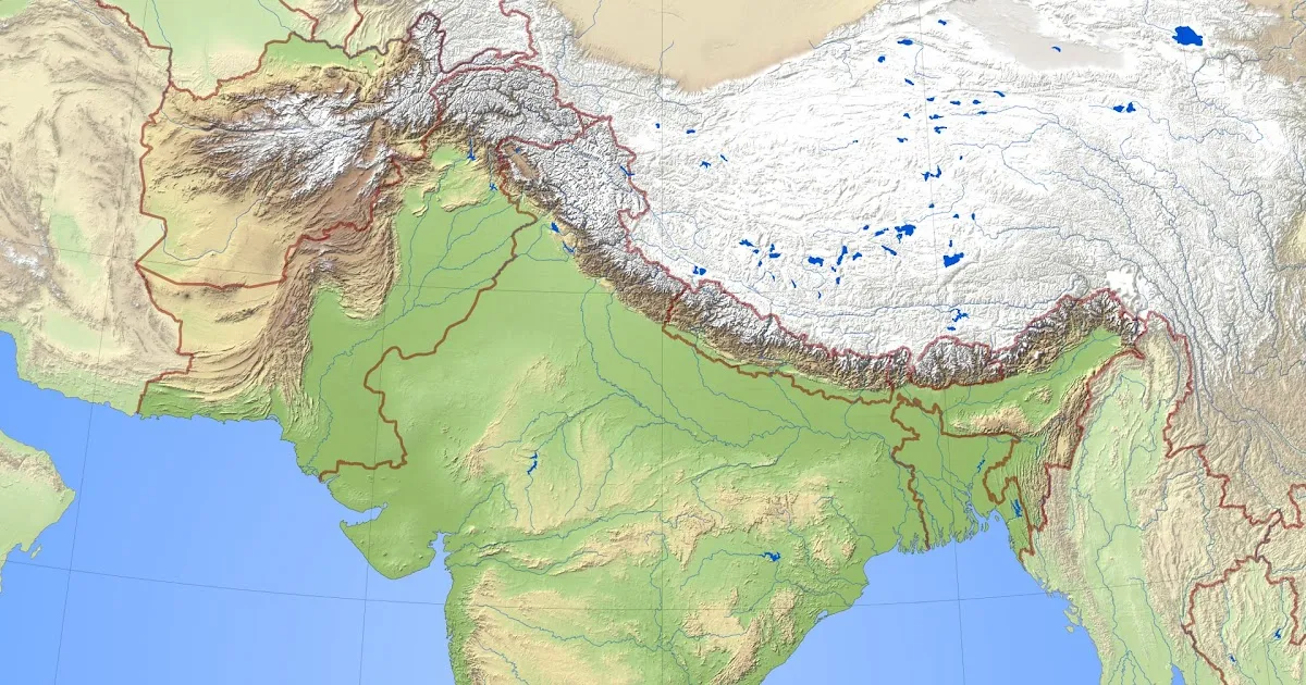
Chapter 2 : Physical Features of India
Lorem Ipsum is simply dummy text of the printing and typesetting industry. Lorem Ipsum has been the industry’s standard dummy text ever since the 1500s, when an unknown printer took a galley of type and scrambled it to make a type specimen book. It has survived not only five centuries, but also the leap into electronic typesetting, remaining essentially unchanged.
Class 9 Geography Chapter 2 : Physical Features of India NCERT PDF
Our Topics Links
Class 9 Geography Chapter 2 : NCERT Question
(Latest CBSE Syllabus)
1 Choose the right answer from the four alternatives given below.
(i) A landmass bounded by sea on three sides is referred to as
(a) Coast (b) Island (c) Peninsula (d) None of the above
(ii) Mountain ranges in the eastern part of India forming its boundary with Myanmar are collectively called
(a) Himachal (b) Uttarakhand (c) Purvanchal (d) None of the above
(iii) The western coastal strip, south of Goa is referred to as
(a) Coromandel (b) Konkan (c) Kannad (d) Northern Circar
(iv) The highest peak in the Eastern Ghats is
(a) Anai Mudi (b) Kanchenjunga (c) Mahendragiri (d) Khasi
2 Answer the following questions briefly.
(i) What is the bhabar?
(ii) Name the three major divisions of the Himalayas from north to south.
(iii) Which plateau lies between the Aravali and the Vindhyan ranges?
(iv) Name the island group of India having coral origin.
3. Distinguish between
(i) Bhangar and Khadar
(ii) Western Ghats and Eastern Ghats
6. Write short notes on the following.
(i) The Indian Desert
(ii) The Central Highlands
(iii) The Island groups of India
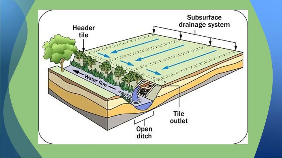
Chapter 3 : Drainage
Lorem Ipsum is simply dummy text of the printing and typesetting industry. Lorem Ipsum has been the industry’s standard dummy text ever since the 1500s, when an unknown printer took a galley of type and scrambled it to make a type specimen book. It has survived not only five centuries, but also the leap into electronic typesetting, remaining essentially unchanged.
Class 9 Geography Chapter 3 : Drainage NCERT PDF
Our Topics Links
Class 9 Geography Chapter 3 : NCERT Question
(Latest CBSE Syllabus)
1. Choose the right answer from the four alternatives given below.
(i) Which one of the following describes the drainage patterns resembling the branches of a tree? (a) Radial (b) Dendritic (c) Centrifugal (d) Trellis EXERCISE 24 CONTEMPORARY INDIA
(ii) In which of the following states is the Wular lake located?
(a) Rajasthan (b) Uttar Pradesh (c) Punjab (d) Jammu and Kashmir
(iii) The river Narmada has its source at
(a) Satpura (b) Brahmagiri (c) Amarkantak (d) Slopes of the Western Ghats
(iv) Which one of the following lakes is a salt water lake?
(a) Sambhar (b) Dal (c) Wular (d) Gobind Sagar
(v) Which one of the following is the longest river of the Peninsular India?
(a) Narmada (b) Krishna (c) Godavari (d) Mahanadi
2. Answer the following questions briefly.
(i) What is meant by a water divide? Give an example.
(ii) Which is the largest river basin in India?
(iii) Where do the rivers Indus and Ganga have their origin?
(iv) Name the two headstreams of the Ganga. Where do they meet to form the Ganga?
(v) Why does the Brahmaputra in its Tibetan part have less silt, despite a longer course?
(vi) Which two Peninsular rivers flow through trough?
(vii) State some economic benefits of rivers and lakes.
Chapter 4 : Climate
Lorem Ipsum is simply dummy text of the printing and typesetting industry. Lorem Ipsum has been the industry’s standard dummy text ever since the 1500s, when an unknown printer took a galley of type and scrambled it to make a type specimen book. It has survived not only five centuries, but also the leap into electronic typesetting, remaining essentially unchanged.
Class 9 Geography Chapter 4 : Climate NCERT PDF
Our Topics Links
Class 9 Geography Chapter 4 : NCERT Question
(Latest CBSE Syllabus)
1. Choose the correct answer from the four alternatives given below.
(i) Which one of the following places receives the highest rainfall in the world? (a) Silchar (c) Cherrapunji (b) Mawsynram (d) Guwahati
(ii) The wind blowing in the northern plains in summers is known as: (a) Kaal Baisakhi (c) Trade Winds (b) Loo (d) None of the above
(iii) Which one of the following causes rainfall during winters in north-western part of India. (a) Cyclonic depression (c) Western disturbances (b) Retreating monsoon (d) Southwest monsoon
(iv) Monsoon arrives in India approximately in: (a) Early May (c) Early June (b) Early July (d) Early August
(v) Which one of the following characterises the cold weather season in India? (a) Warm days and warm nights (b) Warm days and cold nights (c) Cool days and cold nights (d) Cold days and warm nights
2. Answer the following questions briefly.
(i) What are the controls affecting the climate of India?
(ii) Why does India have a monsoon type of climate?
(iii) Which part of India does experience the highest diurnal range of temperature and why?
(iv) Which winds account for rainfall along the Malabar coast?
(v) What are Jet streams and how do they affect the climate of India?
(vi) Define monsoons. What do you understand by “break” in monsoon?
(vii) Why is the monsoon considered a unifying bond?
4. Give reasons as to why.
(i) Seasonal reversal of wind direction takes place over the Indian subcontinent?
(ii) The bulk of rainfall in India is concentrated over a few months.
(iii) The Tamil Nadu coast receives winter rainfall.
(iv) The delta region of the eastern coast is frequently struck by cyclones.
(v) Parts of Rajasthan, Gujarat and the leeward side of the Western Ghats are drought-prone.
Chapter 5 : Natural vegetation and Wildlife
Lorem Ipsum is simply dummy text of the printing and typesetting industry. Lorem Ipsum has been the industry’s standard dummy text ever since the 1500s, when an unknown printer took a galley of type and scrambled it to make a type specimen book. It has survived not only five centuries, but also the leap into electronic typesetting, remaining essentially unchanged.
Class 9 Geography Chapter 5 : Natural vegetation and Wildlife NCERT PDF
Our Topics Links
Class 9 Geography Chapter 5 : NCERT Question
(Latest CBSE Syllabus)
1. Choose the right answer from the four alternatives given below:
(i) To which one of the following types of vegetation does rubber belong to? (a) Tundra (c) Himalayan (b) Tidal (d) Tropical Evergreen
(ii) Cinchona trees are found in the areas of rainfall more than (a) 100 cm (c) 70 cm (b) 50 cm (d) less than 50 cm
(iii) In which of the following state is the Simlipal bio-reserve located? (a) Punjab (b) Delhi (c) Odisha (d) West Bengal
(iv) Which one of the following bio-reserves of India is not included in the world network of bioreserve? (a) Manas (c) Gulf of Mannar (b) Nilgiri (d) Panna
2. Answer the following questions briefly.
(i) What is a bio-reserve? Give two examples.
(ii) Name two animals having habitat in tropical and montane type of vegetation.
3. Distinguish between
(i) Flora and Fauna (ii) Tropical Evergreen and Deciduous forests
4. Name different types of Vegetation found in India and describe the vegetation of high altitudes.
(i) Seasonal reversal of wind direction takes place over the Indian subcontinent?
(ii) The bulk of rainfall in India is concentrated over a few months.
(iii) The Tamil Nadu coast receives winter rainfall.
(iv) The delta region of the eastern coast is frequently struck by cyclones.
(v) Parts of Rajasthan, Gujarat and the leeward side of the Western Ghats are drought-prone.

Chapter 6 : Population
Lorem Ipsum is simply dummy text of the printing and typesetting industry. Lorem Ipsum has been the industry’s standard dummy text ever since the 1500s, when an unknown printer took a galley of type and scrambled it to make a type specimen book. It has survived not only five centuries, but also the leap into electronic typesetting, remaining essentially unchanged.
Class 9 Geography Chapter 6 : Population NCERT PDF
Our Topics Links
Class 9 Geography Chapter 6 : NCERT Question
(Latest CBSE Syllabus)
1. Choose the right answer from the four alternatives given below.
(i) Migrations change the number, distribution and composition of the population in (a) the area of departure (c) both the area of departure and arrival (b) the area of arrival (d) none of the above
(ii) A large proportion of children in a population is a result of (a) high birth rates (c) high death rates (b) high life expectancies (d) more married couples
(iii) The magnitude of population growth refers to (a) the total population of an area (b) the number of persons added each year (c) the rate at which the population increases (d) the number of females per thousand males
(iv) According to the Census 2001, a “literate” person is one who (a) can read and write his/her name (b) can read and write any language (c) is 7 years old and can read and write any language with understanding (d) knows the 3 ‘R’s (reading, writing, arithmetic)
2. Answer the following questions briefly.
(i) Why is the rate of population growth in India declining since 1981?
(ii) Discuss the major components of population growth.
(iii) Define age structure, death rate and birth rate.
(iv) How is migration a determinant factor of population change?
3. Distinguish between population growth and population change.
(i) Flora and Fauna (ii) Tropical Evergreen and Deciduous forests
4. What is the relation between occupational structure and development?
(i) Seasonal reversal of wind direction takes place over the Indian subcontinent?
(ii) The bulk of rainfall in India is concentrated over a few months.
(iii) The Tamil Nadu coast receives winter rainfall.
(iv) The delta region of the eastern coast is frequently struck by cyclones.
(v) Parts of Rajasthan, Gujarat and the leeward side of the Western Ghats are drought-prone.
